Step 2: Station point selection
This is the second step in computing the stakeout data.
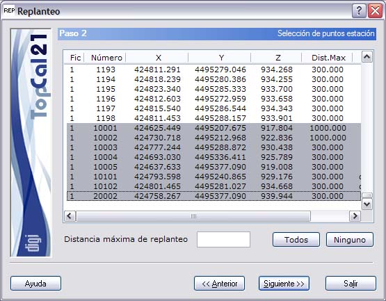
A screen is shown with the points with coordinates stored in the point files selected in Step 1. Select the station points from which the stakeout data for the remaining points will be computed.
The list shown contains the following fields:
- File index: Indicates the index of the point file where the point is stored.
- Point number
- Point coordinates
- Stakeout maximum distance
You can select multiple points by holding down the [CTRL] key and clicking the desired points with the left mouse button. If you click a point that is already selected, it is deselected.
You can also select points arranged in ranges by holding down the [SHIFT] key and clicking the left mouse button on the boundary points that define the range.
Likewise, you can use the All or None buttons to select or deselect all the points.
In addition, a field called Stakeout maximum distance appears, which is useful for changing the distance for each station independently. If you want to change this distance for several points, select the desired points and enter the new distance; it is updated for all of them.
When you have selected the desired points, click the Next button to go to Step 3: Target point selection, or click the Back button to return to Step 1: Enter input data files.