What's new with LIDAR files (.las)
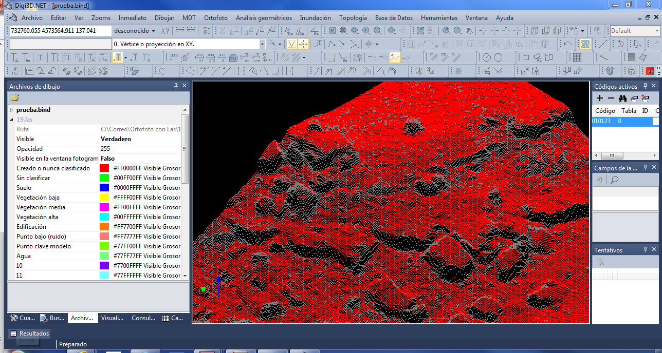 Today we introduce two important new features related to LIDAR files:
- It is now possible to view the clouds of these drawing files in the drawing window, whereas previously they could only be viewed in the photogrammetric window.
- The LIDAR files are now considered a digital terrain model, which means that Digi3D.NET can use them to project in real time or to calculate an orthophoto. Thanks to this feature, you can perform monoscopic stereoplotting with one or more .las files loaded beneath the orthophoto or photo.
Several options have been added to control the display of LIDAR files both in the dialog box Configuration and in the dockable pane Drawing file. In the dialog box Configuration we have a new option titled Import/Export LIDAR files (*.las) with the following options:
| Variable | Description | Default value |
|---|---|---|
| Show by default in drawing window | If enabled, when a LIDAR file is loaded, it will be immediately displayed in the drawing window, but it can be hidden later using the file options in the Drawing file pane | Disabled |
| Consuming graphics card memory | If enabled, the points displayed in the drawing window will be stored in the graphics card's memory. This may consume graphics card memory (for now Digi3D.NET does not optimize point loading), but will make the display immediate. If disabled, no graphics card memory will be consumed but zooms will be slower. | Enabled |
| Show by default in the photogrammetric window | If enabled, when a LIDAR file is loaded, it will be displayed immediately in the photogrammetric window, but we can hide it later by using the file options in the pane Drawing file | Disabled |
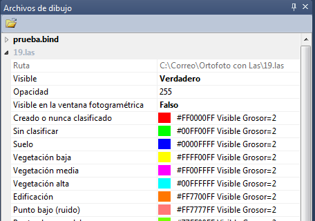
We can control the display of the LIDAR files loaded using the Drawing file pane. If we expand the options menu of the .las file, several options appear that will allow us to activate / deactivate the display of a certain LIDAR file both in the photogrammetric window and in the drawing window. In addition, we can indicate the color with which the points will be displayed depending on the category in which it is classified.
 Once the LIDAR file is loaded (or files, you can load simultaneously as many as you want), we can activate the menu option photogrammetric window/Project the Z coordinate using the loaded MDTs. In this way we can render monoscopic with the guarantee of being using a valid Z coordinate. Activating this option does not slow down the program because the projection is made using algorithms that allow real-time movement.
If you are not going to use the photogrammetric window, but you are going to edit an existing cartography in the drawing window, you can activate the menu option DTM/Project Z when moving over a loaded DTM.
It is no longer necessary to load a .MDT file from MDTopX to calculate the orthophoto if you have LIDAR files of the area (although the performance when calculating an orthophoto is much higher if the digital models of the terrain are files of MDTopX than if they are LIDAR files).