Assigning a coordinate reference system to a new drawing file
Digi3D 2011 It is now possible to specify the horizontal and vertical reference coordinate systems in which the coordinates of the entities stored in a new drawing file will be referenced.
If we create a new drawing file, depending on its extension, the program will allow us to indicate the two reference coordinate systems. I say depending on the extension because certain drawing file formats are not configurable because they have one implicitly associated, such as the .kml format of Google Earth, which implicitly associates the geographic coordinate system WGS 84.
In the following screenshot you can see a clipping of the Import/export parameters section of the New project dialog box, in the Drawing file tab.
 You can check that the program asks both for the horizontal and vertical coordinate system that will be associated with the drawing file created.
If the drawing file already exists, the program will ignore the parameters we indicate here, because the coordinate system associated with a drawing file is immovable, even if it does not have any associated!.
If we click to change a coordinate system, the dialog box Horizontal coordinate system or Vertical coordinate system will appear, depending on the reference coordinate system that we are selecting.
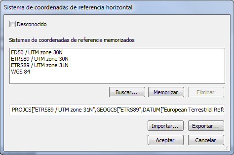 This dialog box allows us on the one hand to indicate that the coordinate system is unknown by pressing the box above completely and on the other hand, if we know the coordinate system, it allows us to select one from the list of memorized coordinate systems.
If we click on one of the memorized coordinate reference systems, the program will show us at the bottom of the box a string Well Known Text representing the selected coordinate reference system.
If you have ESRI Shapefile files with an associated .prj file, you can always import it by pressing the Import button or open it with a notepad, copy its contents and paste it in this window, because .prj files are nothing more than Well Known Text strings that define projections.
If the reference coordinate system you are trying to locate is not stored in the Memorized Reference Coordinate Systems window and you have no Well Known Text string with the coordinate system, you can always press the Buscar... button.
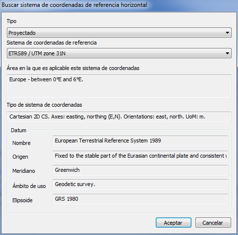 The program will display the dialog box Find horizontal coordinate reference system or vertical coordinate reference system, which allows us to search for a reference coordinate system among those listed in the database EPSG Geodetic Parameter Dataset, which is a database with standardized parameters of all imaginable coordinate systems.
If we accept the dialog box, the Well Known Text string of the previous dialog box will be modified. If we want to memorize the coordinate system we can always press the Memory button, and if we want to remove any coordinate system from the list of stored coordinate systems, we just have to select it and press the Delete button.
Once the drawing file has been loaded, we can check its associated reference coordinate system using one of the two options that appear in the context menu that appears when you right-click on the file name in the pane drawing files.
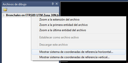 The program will display the horizontal/vertical coordinate system associated with the drawing file if it has one or a window indicating if the drawing file does not have an associated reference coordinate system.
Below you have a video where this is shown in practice.